






How to help map Northampton’s footpaths on Google Street View
Did you know that local people can help improve the way Northampton’s pathways are mapped online?
Published July 30, 2026
Published July 30, 2026
Using a compatible 360 camera, residents can record their journey across local footpaths and upload the footage to Google Street View. This helps create clearer, more accessible digital maps of outdoor routes, making it easier for people to explore local spaces before they visit.
As part of his work with Active Quarter partnership, Dr Declan Ryan at the University of Northampton is encouraging people who have access to a suitable 360 camera to help capture footpaths and walking routes across Northampton.
Declan has already got started. See an example of what his 360 route looks like after it has been uploaded.
View on Google Maps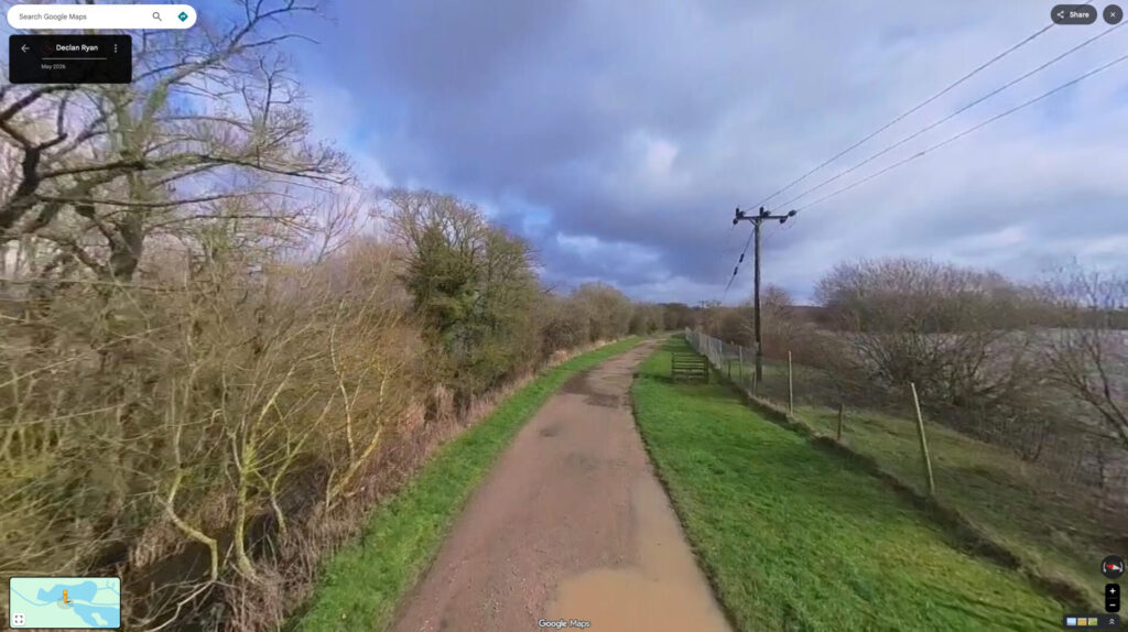
Please remember that anyone recording footage is responsible for using their equipment safely and appropriately. You should take care when walking, cycling, or moving through public spaces, and make sure your equipment does not create a hazard for yourself or others.
Recording in public spaces is permitted, but please be considerate of other people. Google automatically blurs faces and other identifiable information before imagery is published.
To create a Street View route, you will need:
Google provides guidance on creating Street View imagery and compatible 360 cameras you can use. Read the short overview on the Google Street View website.
We used the Insta360 camera and Insta360 app, but others will work just as well.
For the best results, check the manufacturer’s instructions of your camera. Additionally, we found that it helps to…
Once you’ve finished recording, export your footage using your camera manufacturer’s software and upload it through Google Street View Studio.
By helping map local footpaths, residents can support a better understanding of Northampton’s outdoor spaces and make it easier for more people to discover opportunities to move, explore and enjoy the outdoors.
The Active Quarter partnership is not responsible for equipment, recordings, uploads, or any issues that may occur while individuals are creating or submitting Street View imagery.